
Our home
District 5 is Banning’s Eastside.
Nearly 6,000 neighbors live in northeast Banning, generally north of I-10 and east of San Gorgonio Avenue.
Our home
Nearly 6,000 neighbors live in northeast Banning, generally north of I-10 and east of San Gorgonio Avenue.
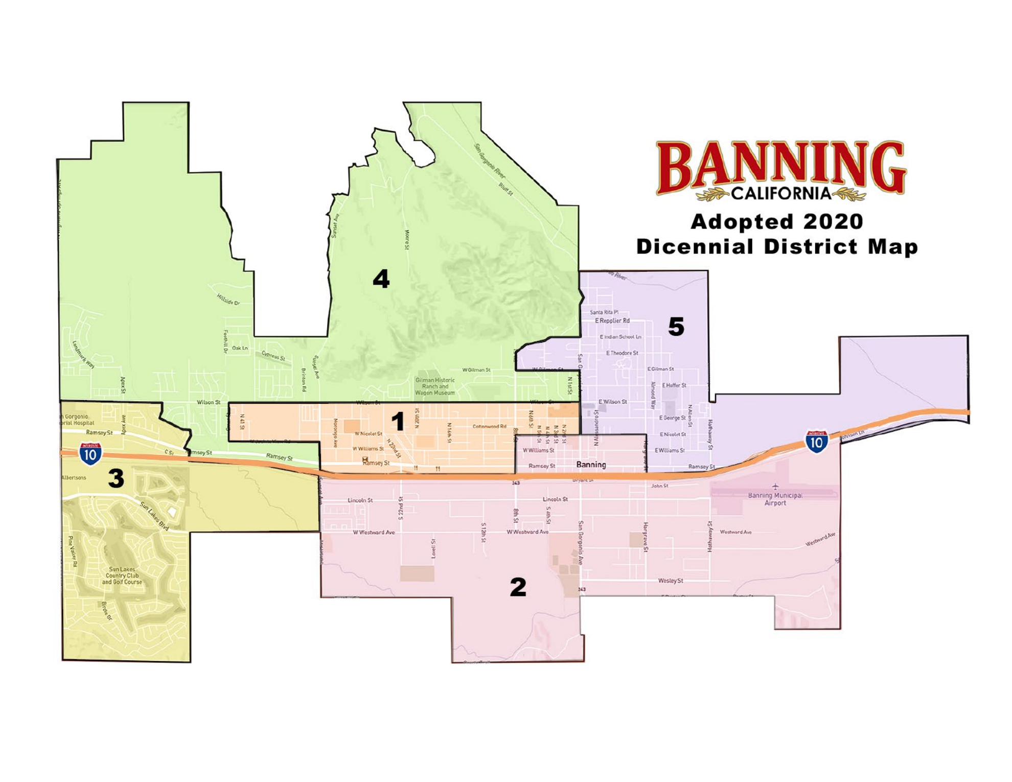
Official City of Banning map, adopted March 2022. View the official map and boundaries ↗
The full picture
District 5 brings together historic neighborhoods and generations of Latino, Black, Hmong, and working-class families on Cahuilla and Serrano homelands.
In 2010, the Grand Jury identified too few sidewalks, streetlights, and parks and said East Banning needed priority attention. Sixteen years later, there is still no public, costed plan to finish the work.
Read the full timelineThe basics first
These needs keep showing up in the public record and in conversations with residents.
Safe, accessible routes to schools, parks, and services.
A public inventory and schedule to repair and expand lighting.
Well-kept public space, trees, shade, and recreation close to home.
Projects with costs, funding sources, dates, and responsible departments.
Official voter tools
Look up your address with the City’s official boundary tool.
Open official tool ↗02Use the Riverside County Registrar of Voters’ official guide.
Open official tool ↗03Districts 4 and 5 will be on the November 3, 2026 ballot.
Open official tool ↗